Five's Maps
Welcome to Fives Maps
Maps of the WWII Online Game World

Sheep Inspected and Approved
Printable Game Maps
Game Maps of the WWII Online Battleground Europe game world since 2001. Originally known as Allied Cartography within the AHC, I changed the name in 2002 to Five's Maps to provide maps to all players.
Everything I create is based on the in-game map. I built the entire theater at 800 meters = 32 pixels. An enormous map broken into 56 files all based on the first sector, the Belgium Sector. An exact copy to the in-game map, a really really really really big map.

|

|
| The Belgium Sector | Source material I use to build maps, 56 Image files that make up the theater. |
Most maps are built to be printed "Fit to Page Landscape". Browse the site, grab what you need and happy printing.
12 Page Map
I put this together carefully and you get a nice wall map on the cheap. Approximately 42 by 24.5 inches put together.

12 Pages - 12Pages.zip
All together in 1 Page - 12page.gif
6 Page Map
1 Page - 6 Page All
6 Pages
- Page 1
- Page 2
- Page 3
- Page 4
- Page 5
- Page 6
4 Page Map of the Zeeland Islands
1 Page - 1 Page
4 Pages
- Page 1
- Page 2
- Page 3
- Page 4
4 Page Theater Map
 |

|
 |

|
The Game World
1 Page Map of the Theater - 135Theater
Construction Maps

Material for what ever you need
Below you will find some material I hope you will find useful for whatever project you're working on. If there is something specific you need just email me, I'd be happy to help.
|
|
AI Maps
AI Guns In Game
See AI Defense for details
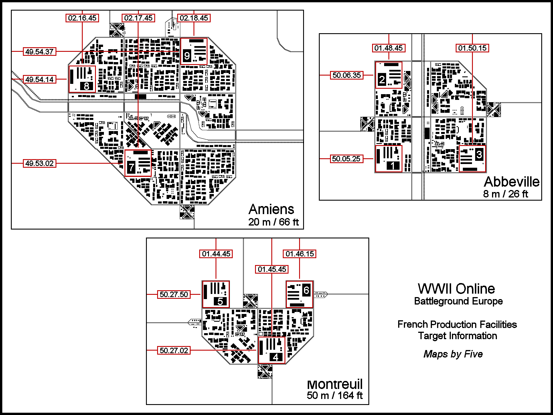
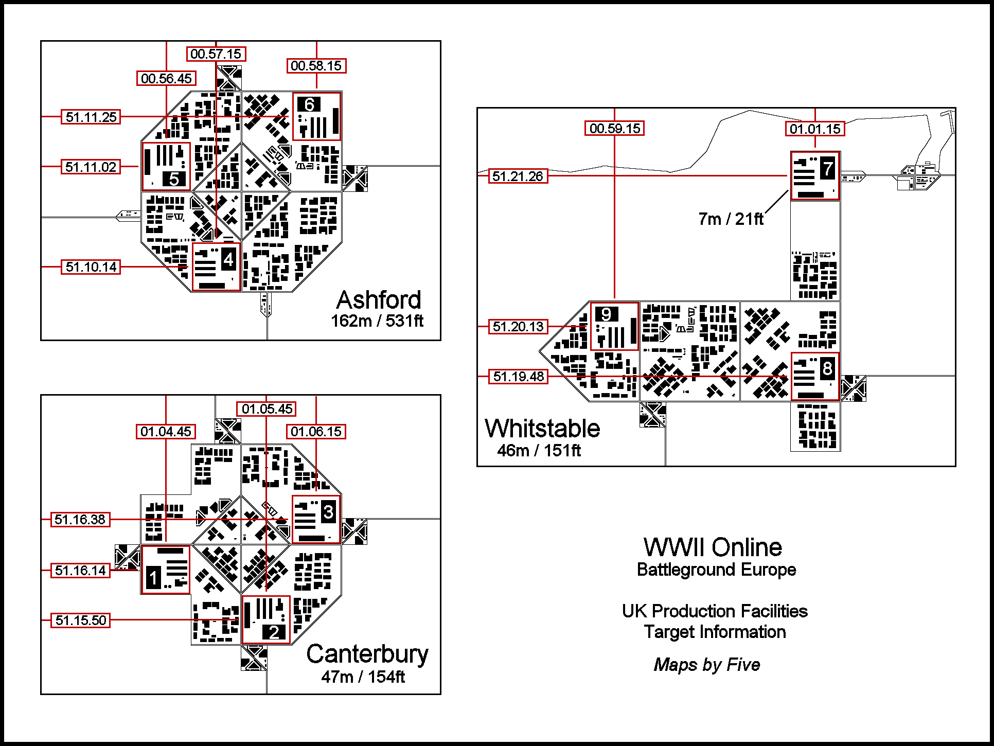
RDP Target Maps
Production Facility Target Maps
Production Facility target maps with coordinates and altitudes.
| Centerline Coordinates | AI Guns Coordinates |
|